blah blah blah
Beech Hill
Length: 1.7 miles out-and-back with loopDifficulty (click for info): Beginner
Elevation Gain: 350 feet (+0 feet on return)
Rating (click for info): 6/10
Elevation: 1883'
Prominence: 363'
Driving Directions:
Trailhead and parking area are on Beech Hill Road in Dublin, NH. From Rt. 101 in the center of Dublin, drive north on Dublin Road for 0.6 miles, then turn left onto the unmarked Beech Hiil Road, which cuts uphill alongside Dublin Road. Drive 0.2 miles up the road and park at a pull-off at a sharp turn, marked by a kiosk with a trail map. Click here for a Google map.
Trail map
About the Hike:
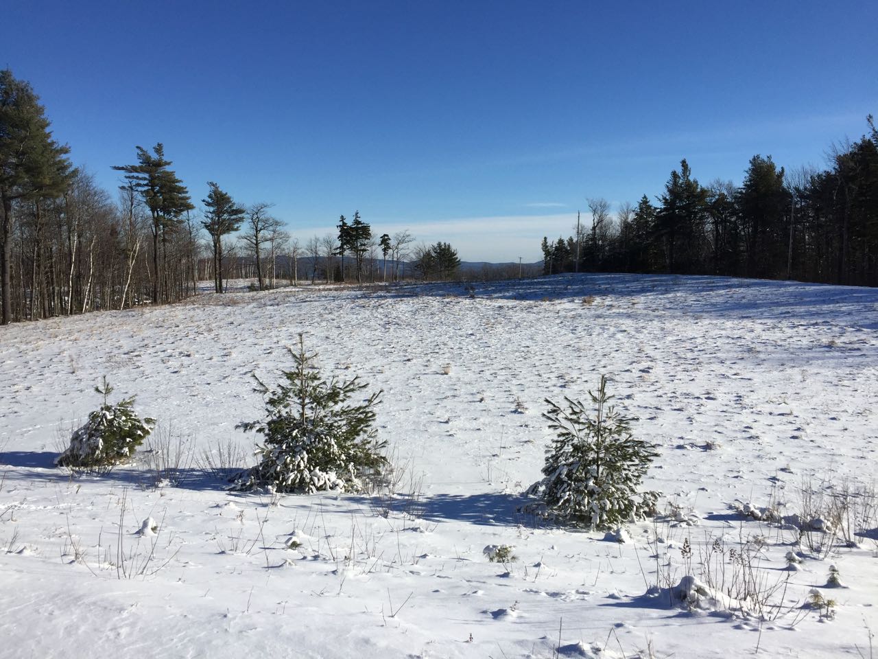
Beech Hill stands on the north side of downtown Dublin and Dublin Pond. The hill has a storied history of many interesting uses. It is most famous for the abandoned 1902 mansion that still stands on its southern slopes, but it is also notable for having a fire tower and a ski area at different times. Today, the hill is within a property owned by the Monadnock Conservancy and has a well-maintained network of hiking trails. The hill offers several very nice ledge viewpoints, and here we describe a nice loop that visits all of them.
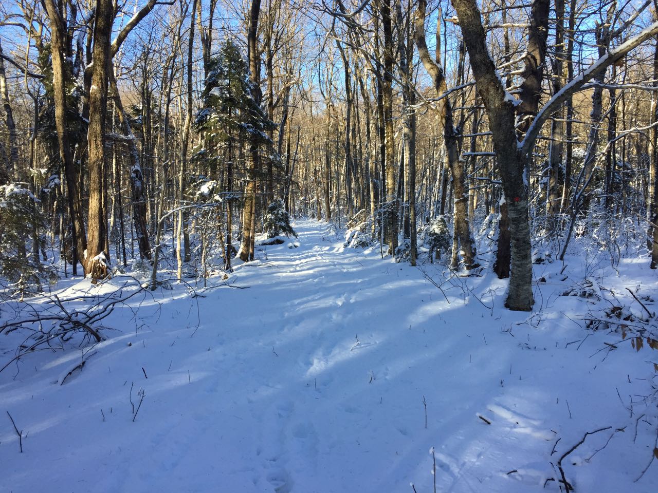
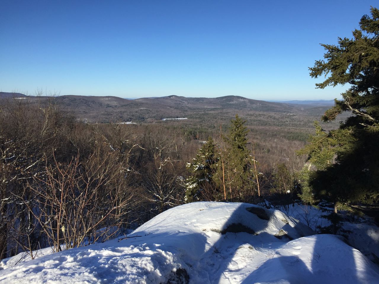
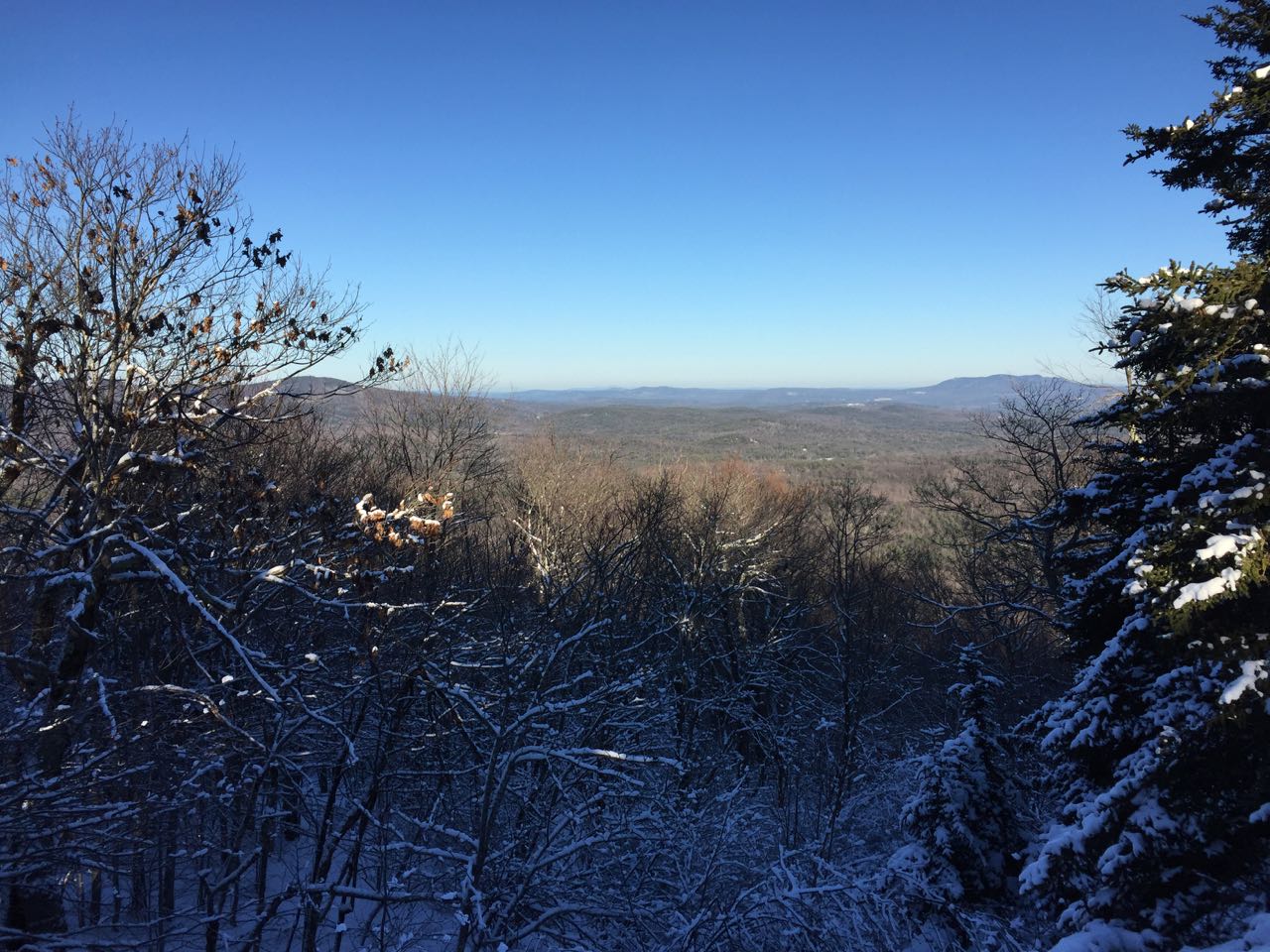
Walk past the kiosk on the path into the forest and shortly take the first left onto Zig Zag Trail. As you might guess, this trail makes liberal use of switchbacks to climb up the hillside. It makes six switchbacks in the 0.4 miles it takes to climb to the top of the hill's main ridge. As the trail flattens out, reach a junction with Ridge Trail and bear left to stay on Zig Zag Trail. Just a few steps ahead, Zig Zag Trail ends at Old Carriage Road. Turn left and walk out onto the continuation of Beech Hill Road, the road you drove in on. Bear right and in a short distance, come out to a large clearing with some communications towers at this end. Follow the road past the towers as it curves to the left along the edge of the clearing. Pass a junction with a connecter to Old Carriage Road, then turn right into the woods onto the South Outlook Spur trail. Pass another short trail leading to a historical cemetery on the right. Walk 0.1 miles slightly downhill, then hop up to a rocky knoll marked with a sign. From here, you can enjoy a nice view over the trees of Mt. Monadnock and nearby Dublin Pond.
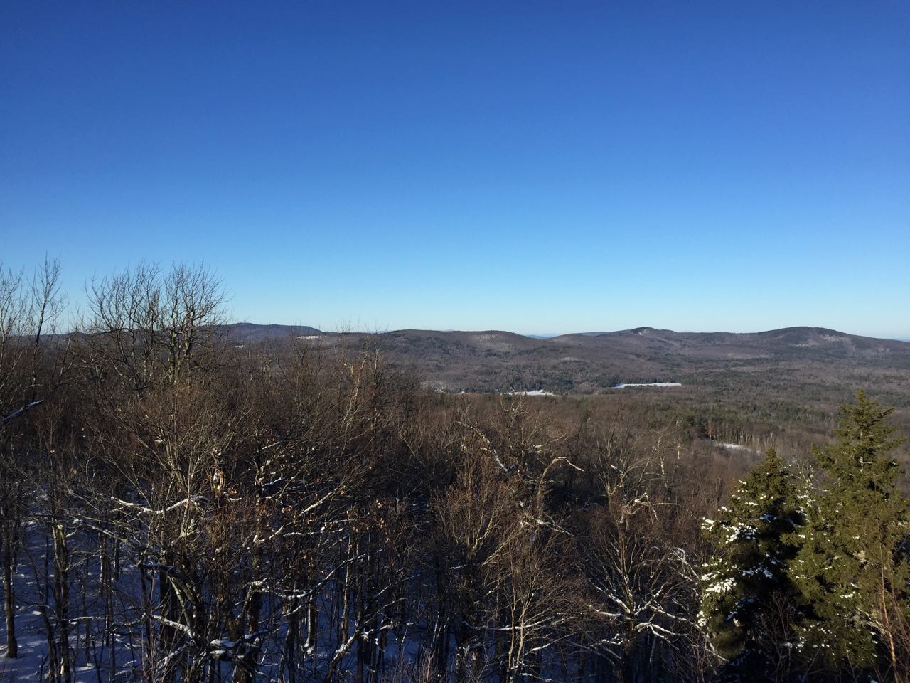
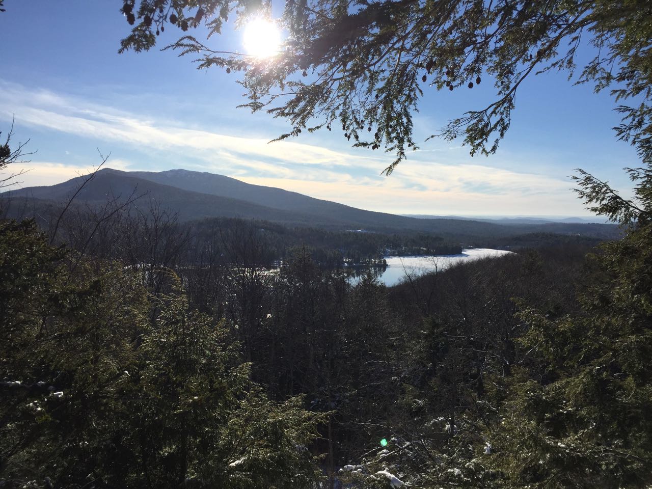
To continue the hike, head back to the road in the clearing and start walking back toward the towers, but before you reach them, bear left into the woods onto the connecter trail, marked with another sign. Follow this for 0.3 miles as it merges with Old Carriage Road and runs level across the hillside through a wide forest corridor. After passing an unmarked, little-used connector trail on the right, turn right onto the red-blazed Ridge Trail. Climb up for a short distance to the top of the summit ridge, and reach a T-junction. Ridge Trail continues to the right. For your next viewpoint, turn left onto a short spur trail that crosses the summit of Beech Hill and leads out to an open vista called Eagle Rock. From here, you look out to a long ridge of nearby hills, Skatutakee and Thumb Mountains and Cobb Hill, over Skatutakee Lake. To the right in the distance, Crotched Mountain can be seen. Across the other side of the opening, you can look back at Mt. Monadnock again. To complete your loop, continue on Ridge Trail. The trail winds across the summit ridge for 0.1 miles to another short spur path on the left. This one leads out to the final viewpoint of your hike, where you look into the distance at Crotched Mountain over one of Beech Hill's abandoned ski slopes. Head down Ridge Trail for another 0.15 miles as you cross a small knob and then descend back to the junction with Zig Zag Trail. You may now turn left and return the way you came.
Printable directions page